Cruising New Zealand's Volatile Coastline
/
There are more cruising options around the coast of New Zealand than ever before. Piggy-backing off the more established Australia and Pacific Islands routes, New Zealand has now become a cruise destination in its own right.
If you're heading to New Zealand think about arriving or departing through Australia and sailing across from Sydney – most cruises cross the Tasman Sea quite quickly, then spend a week (or more) visiting the ports dotted around the New Zealand coast. Or take a cruise around New Zealand's coastline from Auckland. This offers a chance to see a fair amount of the country before arriving on dry land.
Legend has it that Maui fished the North Island of New Zealand out of the Pacific Ocean, while sitting on his canoe, the slightly larger South Island. This poetic birth may help explain the country's often violent landscapes and surreal vistas, but it also answers a lot of questions that quantum physics have yet to address.
New Zealand is a small remote island nation in the lower left corner of the Pacific, and is relatively young on a global scale. But a week spent cruising the coasts of its two largest islands shows just how young this geologically volatile country really is. Auckland, on the upper North Island, is the largest city, with over a third of the country’s five million people. Built around the Hauraki Gulf in the east and the wilder Manukau Harbour in the west it has drawn its heart and soul for generations from the sea - water sports, sailing and a laid-back summer lifestyle. Lesser known is the fact that Auckland straddles 50 volcanic vents, and that the inner Hauraki Gulf is guarded by Rangitoto Island, an active volcano which last erupted just 600 years ago.
We left Auckland’s Queen's Wharf at midnight, sliding out past upmarket apartments stacked on the end of the wharf, steaming slowly out in quiet darkness past Rangitoto Island and in to the outer Hauraki Gulf. By morning we were cruising sedately between the islands at the tip of the Coromandel Peninsula.
Early afternoon we reached the central waters of the Bay of Plenty, an area rich in sea life and a traditional fishing ground for local Maori people. Whakaari White Island, sits 30 miles offshore and, unlike Rangitoto, is a very active volcano. Described by Captain James Cook during his early exploration in the 1700s, the island is shrouded in an ever-shifting gauze of sulphurous steam rising from the collapsed crater. The surrounding cliffs are scorched, naked and scarred, with little vegetation except on the outer slopes of one corner. Whakaari erupts continuously, most recently, and tragically, in 2019. Our ship circled the island several times, giving everyone on board the chance to smell the sulphur, see the steam and watch the seabirds wheeling in the strong breeze.
Next morning we steamed into Tauranga Harbour and tied up beneath the protective cover of yet another volcanic cone, the now extinct Mt Maunganui. Tauranga is a key area in New Zealand’s kiwifruit production and access point to the central North Island.
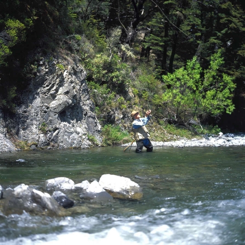
Onshore excursions include Rotorua, an inland city built round the edge of a volcanic caldera lake. Maori have lived here since they first arrived in New Zealand almost 1000 years ago and they welcome visitors to come and share their heritage and culture at several cultural attractions. Rotorua makes the most of its Central Volcanic Plateau location, where the geothermal activity comes bubbling to the surface throughout the area. At places like Waimangu Valley scalding hot pools, glugging mud pools and pounding geysers let the earth vent while creating warm places to swim or cook food. Many backyards in Rotorua have their own thermal vents which are tapped for steam rooms and hot pools in the family garden.
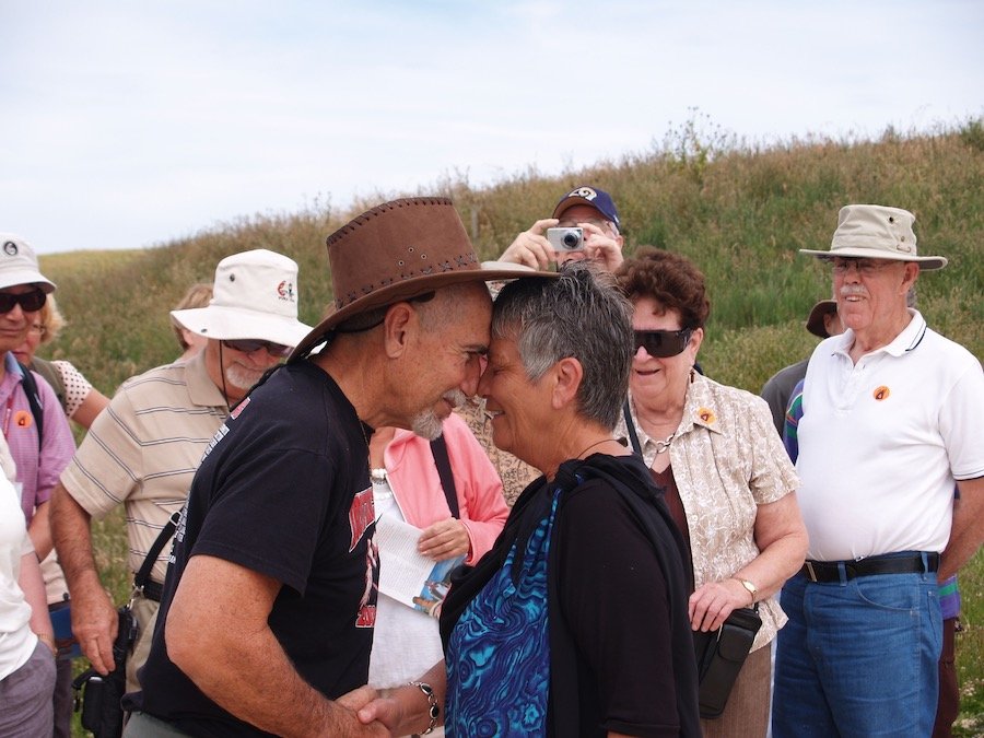
A hongi greeting at the hakikino pa
But at Napier, another night's cruising down the coast, the earth vented in a very different way, when, in 1931, the city was almost destroyed by a 7.9 earthquake. While Napier was thrashed to its knees as most of its buildings were destroyed and a large fire broke out, it also gained many acres of land due to uplift, including the Marine Parade beach along the waterfront. The city was quickly rebuilt in a bold display of Art Deco architecture, and it is now the best small city example of Art Deco building in the world. Maori Deco, a local variation using traditional indigenous motifs (kowhaiwhai) and carving styles (whakairo), is best seen in the ASB bank building just a block back from the sea in the main shopping area.
On a Maori cultural excursion from Napier we were treated to a different Maori experience when we visited the ancient Hakikino pa (fortified village) site at Waimarama. As with local tradition, men and women walked separately onto the marae (the meeting area), led by two strong, well-fed warriors flashing their eyes and twirling carved weapons. Their soft feet padded on the sandy soil and their harakeke skirts swayed and rustled as they moved. We were welcomed with a waiata, or song, and listened as they shared their family stories, art and music, and their language. This was a privileged peek into the local indigenous culture, one we were all very moved to have been part of.
We cruised through the night, arriving at Wellington at the southern end of the North Island in the early morning. Wellington is New Zealand's capital city (recently called the Coolest Little Capital in the World, by several publications) and has a boisterous climate and a very shaky history. It also gained a considerable amount of inner city real estate following a massive 8.2 earthquake in 1855. Tour guides here proudly park on the fault line which runs through the hills behind the city while explaining how Lambton Quay, where sailing ships once tied up and city provisions were unloaded, is now several blocks back from the city waterfront due to seismic uplift.
From Wellington we crossed Cook Strait during the night. This notoriously rough stretch of water separating the North and South Islands barely had us moving in our beds as we powered through a moderate sea, to awake in the morning at Picton, on the northern coast of the South Island. Here the beautiful landforms of the Marlborough Sounds have been shaped by water, not seismic violence, as drowning valleys slip ever so slowly under the sea. Maori explain it as the prow of Maui’s canoe dipping into the sea as he fished up the North Island - it sounds so much nicer.
But we were maybe saved the best for last, as several days later we rounded the southern coast of the South Island and entered the flat calm waters of Fiordland’s fiords. Unlike the waterways around Picton, these staggeringly steep hills and waterways were shaped by glacial action. Doubtful Sound, also named by James Cook, is the star of the area with the ship passing between high promontories, almost vertical mountainsides and shadowy bluffs. The very high rainfall here creates a golden layer of freshwater, sometimes metres thick, which sits on the seawater and cuts the light levels into the sea beneath. This allows unusual organisms like black corals, spongy sea pens and red hydrocorals to grow within easy diving depth, unlike anywhere else in the world.
As there are no port facilities in Fiordland and the water is too deep to anchor we motored off later in the day towards the setting sun. Next stop would be Australia, several days to the west across the Tasman Sea.
(C) Sue Farley 2022 (updated)